Utilizing Agent-Based Model for Campus Planning
Conduct an agent-based simulation model for pedestrian analysis in CYCU campus greenery planning
Research Project
Year: 2022 (Year 4)
Type: Individual Work
Location: Taoyuan, Taiwan
Instructor: Chen Hung-Ming
Leading approch to public space design
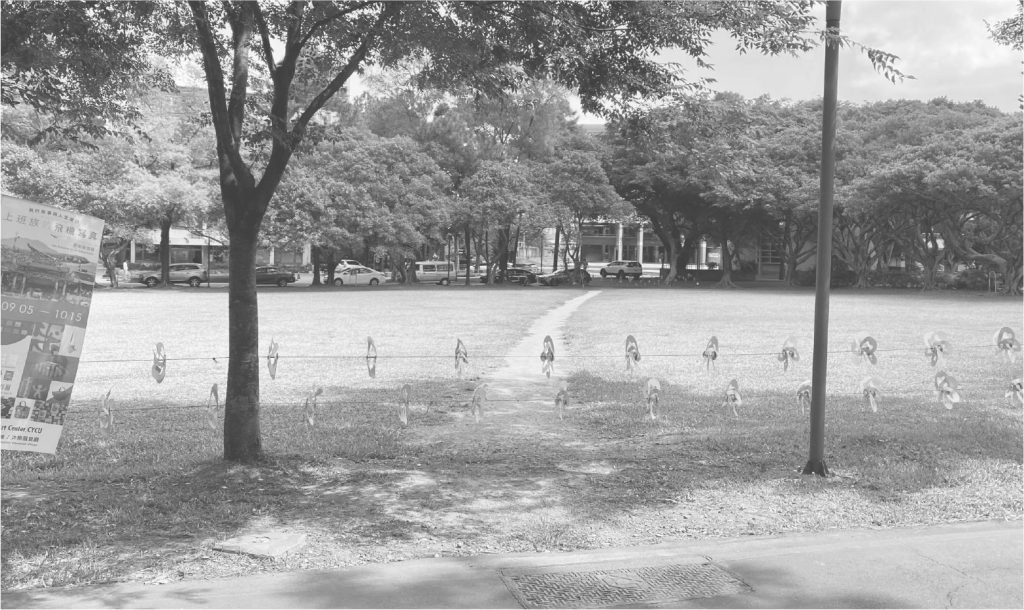
The central lawn at Chung Yuan Christian University have been marred by the indelible trails of pedestrian shortcuts. Such an imprint not only signified the incongruity between designed spaces and organic human movement but also beckoned a comprehensive rethinking of campus planning.
This research, therefore, commences with a holistic approach that scrutinizes lawn segmentation practices within a variety of academic institutions. The array of data analytics probes the pedestrian flows, leading to agent-based simulations. This investigative trajectory, bridging the observational with the analytical, lays a solid foundation for a profound understanding and reconfiguration of the spaces that pulse with campus life.
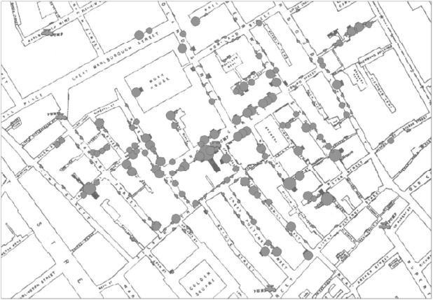
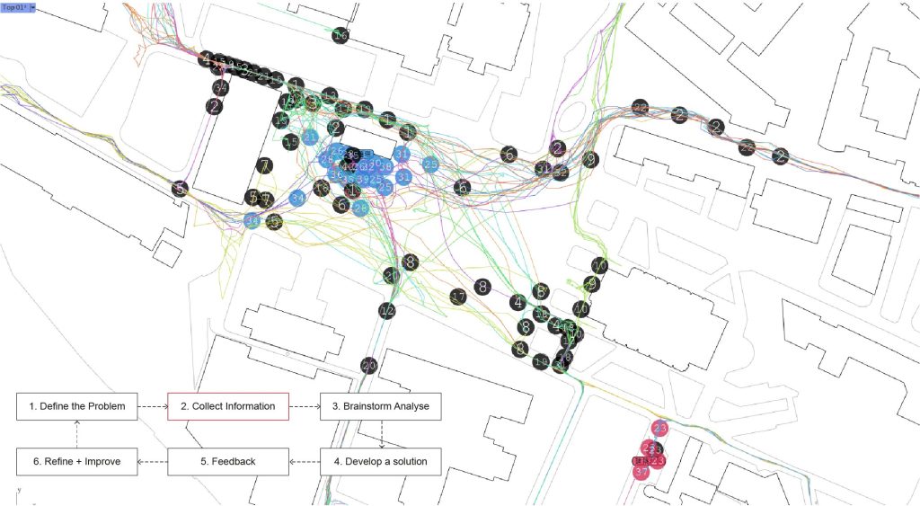
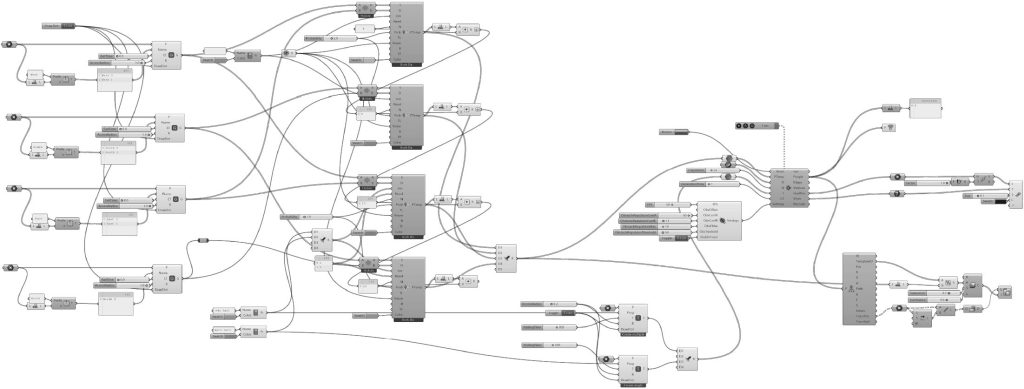
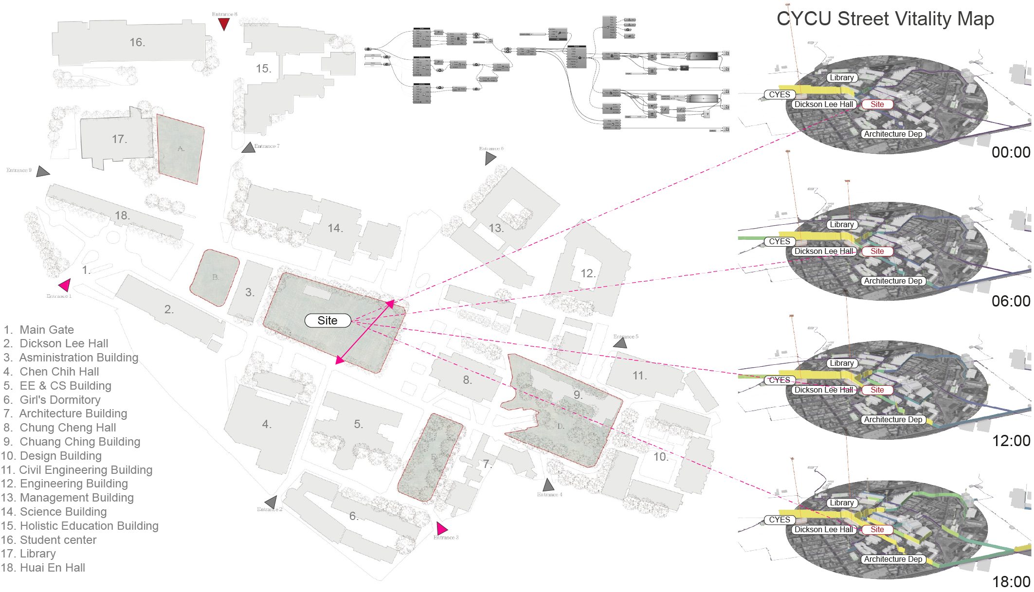
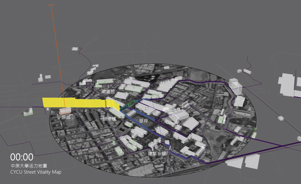
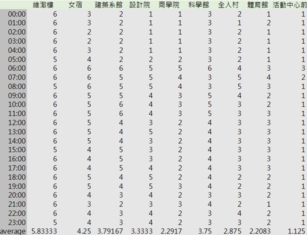
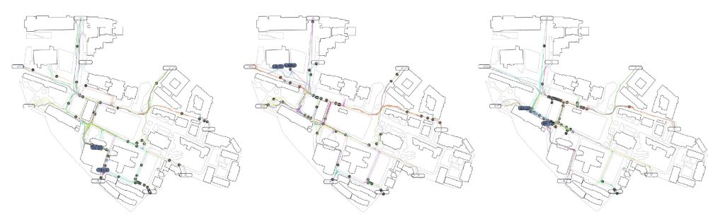
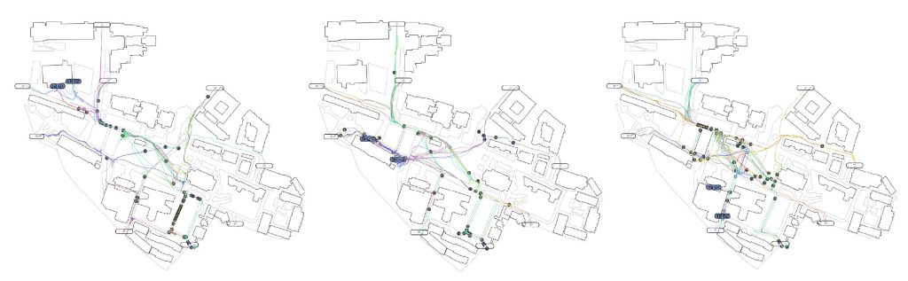
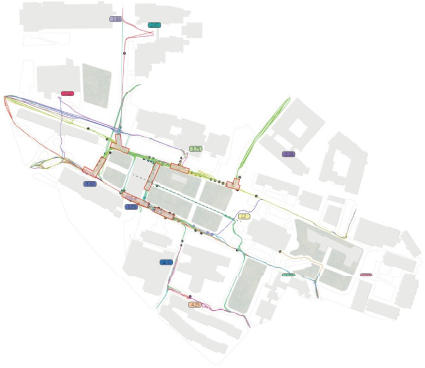
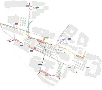
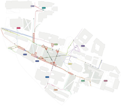
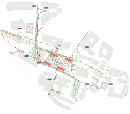
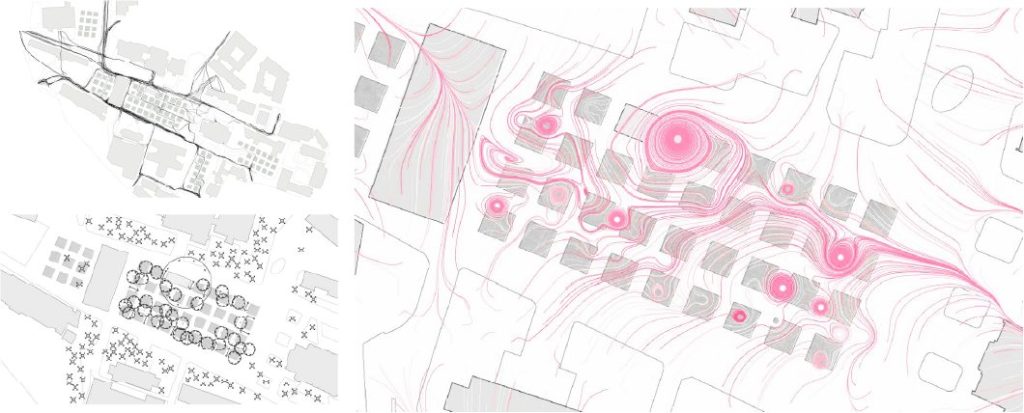
[Phase One: OSM Street Vitality Data Analysis]
The study began with a comprehensive analysis of street vitality using OpenStreetMap (OSM) data. This phase focused on extracting and interpreting spatial data related to the campus streets, identifying patterns of use and areas of high pedestrian traffic. By establishing temporal checkpoints and analyzing the flow of movement across different times of day, the research aimed to capture a snapshot of the university’s dynamic pulse. The vitality data gleaned from this analysis provided a solid foundation for understanding how the campus’s physical layout affects pedestrian behavior and the wear patterns on green spaces.
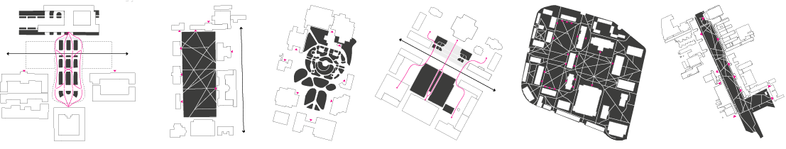
[Typological Analysis of Campus Lawn Segmentation]
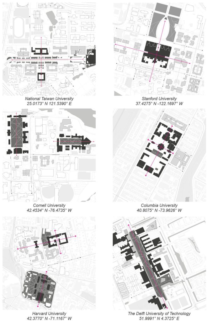
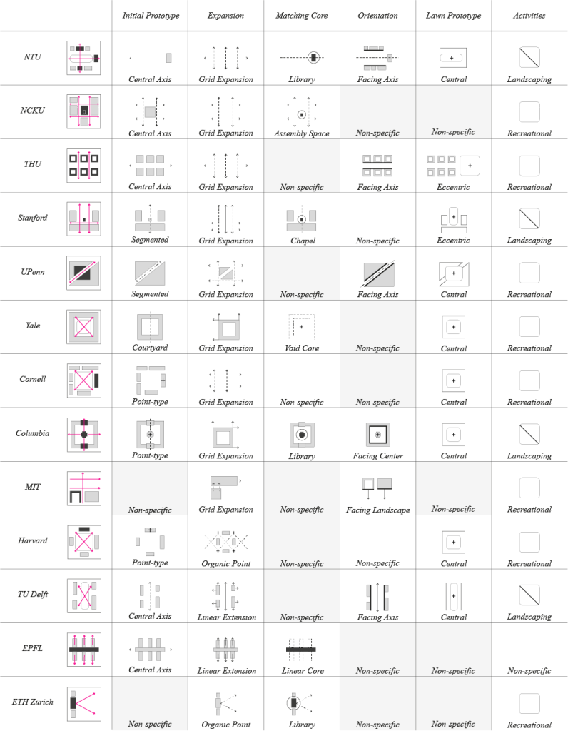
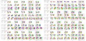
[Phase Two: Typological Analysis]
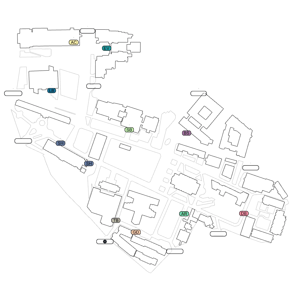
With a firm grasp of the campus’s spatial dynamics, the second phase shifted attention to a typological analysis. This stage involved a comparative study of lawn segmentation strategies by examining a variety of universities both within Taiwan and worldwide. The goal was to understand the range of existing approaches to managing pedestrian traffic through landscape design. This exploration of different segmentation methods informed the potential for implementing similar or novel strategies in the context of Chung Yuan Christian University.
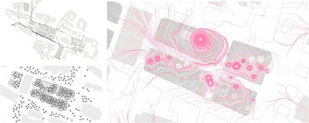
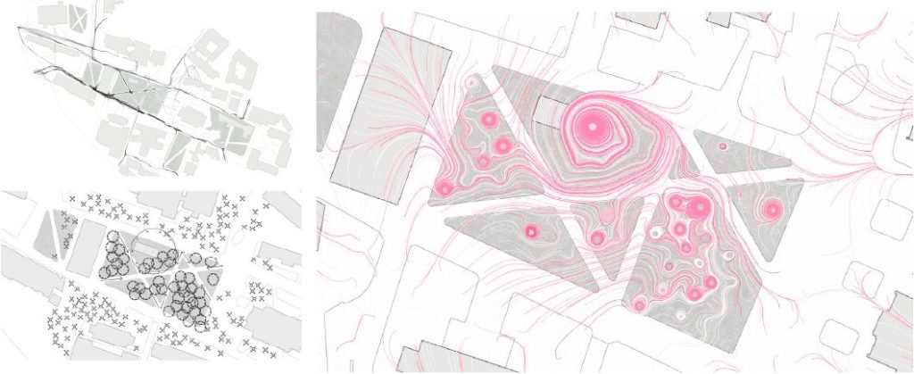
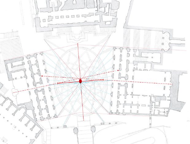
[Phase Five: Magnetic Field & Attraction Model]
Following the typology and pedestrian flow simulation phases, the results led to the subsequent inquiry: Is a standardized turf division approach suitable for CYCU? Consequently, I simulated pedestrian engagement with new varieties of lawn spaces and applied these findings to a magnetic field to generate an attraction model, seeking an organic method for turf segmentation.

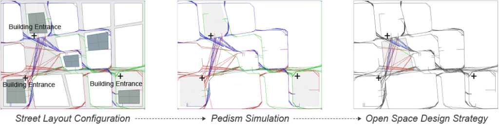
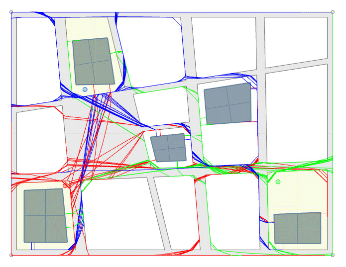
[Pedism Simulation as Design Strategy]
The user experience in public spaces is an essential consideration in spatial design. Therefore, under this premise, I have incorporated users’ behavioral patterns into my analysis. I conducted a cause-and-effect analysis of various decisions and used these conclusions as design strategies to ensure that public spaces meet expectations.
Moreover, leveraging current computer technology for simulation and computation is crucial. This approach enables design to evolve in response to function, ensuring spaces are not only functional but also align with how they are used and experienced by people. This integration of technology and user-centered design is key in creating effective public spaces.